The Central Meteorological Observatory will continue to issue typhoon blue warnings at 6:00 on October 25. The center of this year’s No. 30 typhoon “Qiangbi” weakened from a strong tropical storm level to a tropical storm level early this morning. At 5 o’clock in the morning, its center was located on the southern sea surface of the East China Sea, about 730 kilometers south-west of Kagoshima, Japan. The maximum wind force near the center was level 9 (23 meters/second), the lowest pressure at the center was 990 hPa, and the radius of the level 7 wind circle was 260-400 kilometers.
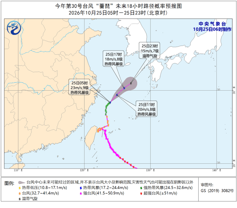
“Qiangpi” is expected to move northeast at a speed of about 25 kilometers per hour, rapidly weaken in intensity, and gradually transform into an extratropical cyclone.
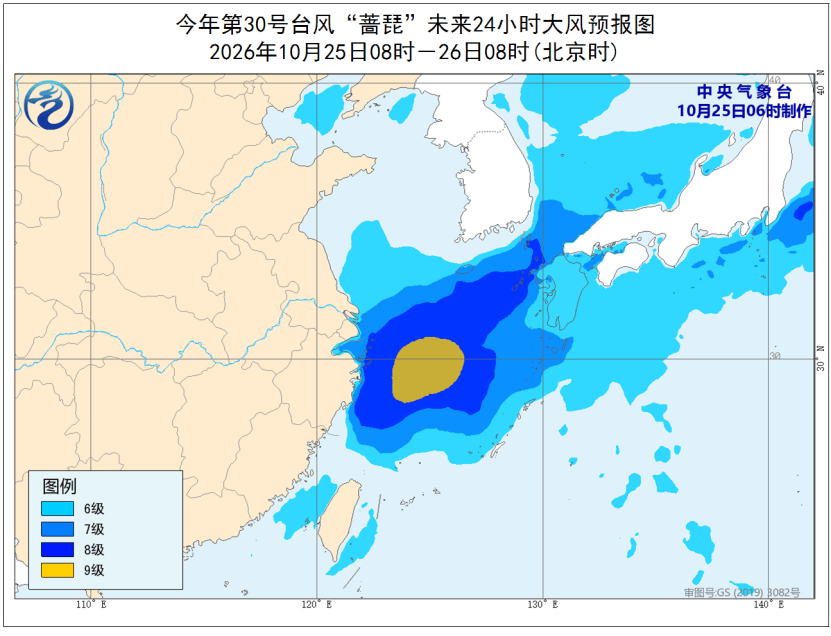
From 8:00 on the 25th to 8:00 on the 26th, due to the joint influence of cold air and typhoon “Qiangpi”, there will be strong winds of magnitude 6-8 and gusts of magnitude 9-10 in the Bohai Sea, the northern and southern waters of the Yellow Sea, most of the East China Sea, the Taiwan Strait, the ocean east of Taiwan, the Yangtze River Estuary area, Hangzhou Bay, the coast of Jiangsu, and the northern coast of Zhejiang. Among them, the wind force in the northern part of the East China Sea has magnitude 9 and gusts of magnitude 10-11.
Related Reading
- “Adaxi” who was “selected” by traffic2026-10-25
- The first AI movie to win the “Dragon Label” has a box office of over 500,000 yuan. Can it retain the audience for 100 minutes?2026-10-25
- Tibet Baqing earthquake rescue progress: Power supply has been fully restored, 36 people were injured in the hospital, and the remaining injured have been discharged from the hospital after treatment2026-10-25
- U.S. intelligence warns Iranian plots to kill Americans are in ‘advanced stages’2026-10-25
- Autumn is deep and the leaves are red! The most beautiful autumn colors in these places are online2026-10-24