A powerful nor’easter is battering the East Coast this weekend, bringing major coastal flooding, damaging winds and heavy rain from the Carolinas to southern New England.
About 84,600 homes and businesses were without power across five Northeast states by midday Saturday, according to PowerOutage.us, with New Jersey, Connecticut and Long Island hit hardest. Wind gusts topped 60 mph on Long Island, Cape Cod and the islands, according to the National Weather Service, and more than 400 flights were canceled nationwide, most of them at Boston Logan.
Water rose more than 3 feet above the normal high-tide mark Saturday morning at the Jersey Shore and in New York Harbor, according to preliminary NOAA data. In Queens, video showed people kayaking to the Howard Beach–JFK subway station. New York Gov. Kathy Hochul and New Jersey Gov. Mikie Sherrill have both issued emergency declarations, and more than 20 million people from Virginia to New Jersey are under coastal flood warnings.
Forecasters warned that flooding could return with Saturday night’s high tide as the storm moves toward the Jersey Shore late Saturday into Sunday, according to the Weather Prediction Center. The storm is expected to weaken slowly Sunday night and move northeast Monday.
How to stay safe:
-
Never drive or walk through floodwaters. Just 6 inches of moving water can knock a person down.
-
Move cars out of flood-prone areas before high tide.
-
If you live in a basement or ground-floor apartment, have more than one way out.
-
Stay away from downed power lines and report them to your utility or 911.
-
In New York City, text NOTIFYNYC to 692-692 for emergency alerts.
Follow below for the latest updates.
-
Jack Brewster
Hotel guests evacuated in Edgewater, N.J.
Emergency workers evacuated about 20 people from a waterfront Comfort Inn in Edgewater, N.J., on Saturday morning after its first floor flooded, and were going back for more, The New York Times reported.
-
Jack Brewster
FAA warns of possible ground stops at New York airports tonight
Federal air traffic officials warned that ground stops or delays are possible Saturday evening at the three major airports serving New York City, according to an FAA advisory. Boston Logan remains the hardest hit so far, with about a quarter of its flights canceled.
Amtrak has also canceled several trains, including service between Connecticut and Massachusetts and some trains between Boston and Philadelphia, citing weather and downed wires.
-
Jack Brewster
Storm cancels concerts, races and ballgames across the Northeast
Along with the Global Citizen Festival and Ed Sheeran’s Gillette Stadium shows, organizers across the region have canceled or rescheduled events because of the storm:
-
AC/DC’s Friday concert at MetLife Stadium in East Rutherford, N.J., was postponed to Oct. 2, the stadium said.
-
All Things Go, a three-day music festival in New York City, was canceled, with refunds offered.
-
Saturday’s Yankees-Orioles game was moved to a Friday doubleheader, and tickets can be exchanged.
-
An Ironman triathlon at Jones Beach was canceled.
-
Horse racing at Belmont Park was canceled Saturday and Sunday, the New York Racing Association said.
-
The New York Renaissance Faire in Tuxedo Park is closed for the weekend, with automatic refunds, organizers said.
-
-
Jack Brewster
Water recedes after morning high tide, but flooding could return tonight
Water levels along the New York and New Jersey coast fell well below their morning peaks by early Saturday afternoon, according to NOAA tide gauges. At the Battery in Lower Manhattan, the water dropped more than 5 feet from its 9:36 a.m. peak by just after 2 p.m.
However, the drop is temporary. The next high tide is expected around 8:15 to 9 p.m. along the city’s south shore and near midnight along Long Island Sound, according to NYC Emergency Management, with moderate flooding expected again in Jamaica Bay and the Rockaways. Forecasters have said the heaviest rain in the city will also arrive tonight, which could slow drainage in low-lying areas.
-
Jack Brewster
PSEG Long Island says it has restored power to more than 23,000 customers
PSEG Long Island said Saturday morning that it had restored power to more than 23,000 customers since 7 a.m. Friday, and that more than 850 line workers, tree trimmers and other field staff were responding, according to a storm update. The utility said the hardest-hit areas were the Town of Huntington and the South Shore of western Suffolk County.
PSEG Long Island warned that more outages are likely as the wind and rain continue, and that strong winds could temporarily slow repairs because crews can’t safely work in bucket trucks in high gusts.
-
Jack Brewster
Floodwater pours into homes at the Jersey Shore
Floodwater swept through the streets of Surf City, N.J., on Saturday and got into some homes, the Associated Press reported. In Manasquan, about 34 miles up the coast, roads were also underwater, and Mayor Mike Mangan said he expected “a lot of water in the streets for a long time.”
In Sea Bright, Mayor Brian Kelly said he expected this storm to be worse than the one or two floods the borough typically sees each year.
“I think this one will be closer to an Irene-scale flooding event,” Kelly told the AP, referring to the 2011 hurricane. “I hope I’m wrong, but that’s my gut feeling.”
The borough opened its recreation center for residents who evacuate.
-
Jack Brewster
Why a September nor’easter can bring down more trees
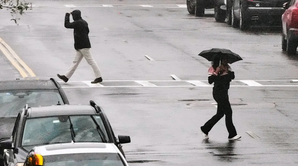
Pedestrians cross Broadway during a rain storm in the South Boston neighborhood during a nor’easter, Saturday, Sept. 26, 2026, in Boston. (AP Photo/Charles Krupa)
(AP Photo/Charles Krupa)Nor’easters are common in the fall, but this one arrived while trees are still full of leaves, National Weather Service meteorologist Matthew Belk told the AP. Leaves catch more wind, which raises the risk of falling limbs, power outages and debris on roads.
The storm’s north-northeast winds are also unusual, which state officials in New York said could make wind damage worse, according to Gov. Kathy Hochul’s office.
-
Jack Brewster
Up to 3.5 feet of flooding possible on Long Island’s South Shore, Hochul says
The southern shores of Queens, Nassau County and southwestern Suffolk County could see up to 3.5 feet of floodwater in the most vulnerable spots, Gov. Kathy Hochul’s office said Saturday. The Long Island Rail Road’s Long Beach branch faces delays and partial suspensions because of flooded tracks, and several Queens bus routes are detouring around flooded streets.
-
Jack Brewster
NYC officials warn tonight through Sunday morning is the storm’s worst stretch
New York City’s heaviest rain is expected to begin around 8 p.m. Saturday and continue into Sunday morning, NYC Emergency Management said after a coordination call with the National Weather Service. Bands of rain could fall at up to an inch an hour, with some neighborhoods getting 2 to 3 inches overnight and isolated flash flooding possible.
Officials called tonight through late Sunday morning the worst time to travel. Gusts of 45 to 55 mph are expected to continue, with an isolated gust near 60 mph possible, bringing more downed trees and outages.
The next high tide arrives around 8:15 to 9 p.m. on the city’s south shore and near midnight along Long Island Sound, with moderate flooding expected in Jamaica Bay and the Rockaways. Sunday’s midday tide could bring moderate flooding to the coastal Bronx and northern Queens, including parts of Flushing and Astoria, officials said.
Residents can report damage at reportdamage.nyc.gov, and basement apartment residents can sign up for automated flood calls at nyc.gov/notify.
-
Jack Brewster
Outages climb past 80,000 across the Northeast
About 84,600 homes and businesses were without power across New Jersey, Connecticut, New York, Massachusetts and Rhode Island as of about 12:20 p.m. Saturday, according to PowerOutage.us.
New Jersey had the most outages, about 30,500, led by Ocean County with more than 8,500. Connecticut had about 24,600, with roughly 6% of customers out in both New London and Litchfield counties. In New York, about 21,700 customers were without power, including nearly 9,500 in Suffolk County on Long Island.
-
Jack Brewster
Gusts top 60 mph on Long Island, Cape Cod and the islands
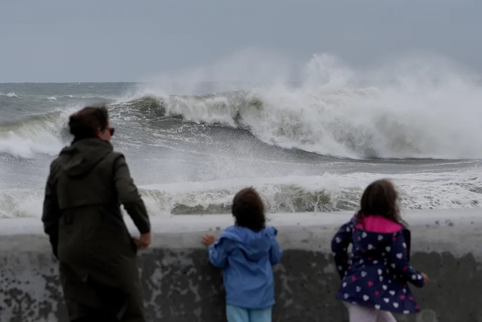
Spectators watch wave break during a nor’easter storm, Saturday, Sept. 26, 2026, in Hampton, N.H. (AP Photo/Robert F. Bukaty)
(AP Photo/Robert F. Bukaty)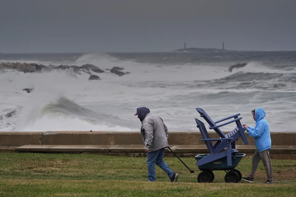
Chuck and Teresa Palmieri move lawn furniture to a safe location at a relative’s seaside property as the Atlantic Ocean kicks up surf during the early stages of a nor’easter storm, Friday, Sept. 25, 2026, in Gloucester, Mass. (AP Photo/Robert F. Bukaty)
(AP Photo/Robert F. Bukaty)Wind gusts topped 60 mph in parts of Long Island, southeastern Massachusetts and Rhode Island overnight and Saturday morning, according to reports compiled by the National Weather Service’s New York and Boston offices.
Nantucket’s airport recorded a 64 mph gust, and Farmingdale Airport on Long Island and Martha’s Vineyard Airport both recorded gusts of about 60 mph. Weather stations at Eatons Neck and Stony Brook on Long Island’s North Shore measured gusts of 65 to 66 mph.
Closer to New York City, JFK Airport recorded a 56 mph gust Friday night, LaGuardia 46 mph and Newark 47 mph. Boston’s Logan Airport recorded 51 mph Saturday morning.
-
Jack Brewster
Water rose more than 3 feet above normal high tide at the Jersey Shore and in New York Harbor
Water levels rose more than 3 feet above the normal high-tide mark at several points along the New Jersey and New York coast Saturday morning, according to preliminary data from NOAA tide gauges.
The gauge at Sandy Hook, N.J., peaked at about 3.4 feet above normal high tide shortly after 8:30 a.m. Atlantic City and the Battery in Lower Manhattan each peaked at about 3.3 feet. At Kings Point, on the western end of Long Island Sound, water reached about 3.4 feet above normal just before noon.
Forecasters have warned that flooding could return with Saturday night’s high tide.
-
Jack Brewster
Flood sensors show water nearly 2.5 feet deep in parts of NYC
Street-level flood sensors recorded water nearly 2.5 feet deep on City Island in the Bronx as of midday Saturday, according to FloodNet, a sensor network run by New York City, CUNY and NYU.
A sensor at Ditmars Street and Hunter Avenue on City Island measured 29 inches of water around 12:30 p.m., which FloodNet classifies as major flooding. In Howard Beach, Queens, a sensor on Davenport Court recorded 17 inches, and one in Rosedale, Queens, recorded 14 inches, both in the moderate range.
Smaller amounts of flooding were recorded in Carroll Gardens and Canarsie in Brooklyn and in the Rockaways. Most sensors elsewhere in the city showed little or no standing water.
-
Jack Brewster
Video appears to show kayakers paddling to Queens train station
A video posted Saturday morning by storm chaser Nicholas Isabella appears to show people kayaking through floodwaters toward a train station in Queens. It had drawn more than 1.6 million views on X by midday.
“The water is so high people are kayaking to the train station in Queens,” Isabella wrote.
In the 15-second clip, two people paddle kayaks toward the station’s entrance stairs as water surrounds the building and partly covers cars parked nearby. Signage on the station appears to read “Howard Beach JFK.”
Yahoo News could not independently verify the video’s exact location. Flooding in the borough appeared to be localized, with some residents elsewhere in Queens reporting dry streets.
Howard Beach, Far Rockaway and Rosedale in southern Queens were among the neighborhoods seeing moderate flooding Saturday morning, according to Gothamist, which cited the city’s FloodNet sensor network. The MTA had closed the storm doors at its Howard Beach train yard ahead of the storm, amNY reported.
-
Jack Brewster
Also happening: Hurricane Nolo lashes Hawaii’s Big Island
A list of mainly canceled flights are displayed at Hilo International Airport as Hurricane Nolo sits nearby Friday, Sept. 25, 2026, in Hilo, Hawaii. (AP Photo/Gregory Bull)
(AP Photo/Gregory Bull)In the Pacific, Hurricane Nolo was a Category 2 storm with maximum sustained winds of 105 mph as of late Friday, stationary about 145 miles south of South Point on the Big Island, Big Island Now reported.
Tropical storm conditions were already affecting parts of the island, and forecasters said hurricane conditions were possible Saturday morning, especially in steep terrain. The Big Island is under a tropical storm warning, a hurricane watch and a flood watch, and large swells from the storm are creating life-threatening surf and rip currents along east- and south-facing shores.
-
Jack Brewster
Where the heaviest rain is expected
Storm watchers stand inside a seawall during a nor’easter storm in Hampton, N.H., Saturday, Sept. 26, 2026. (AP Photo/Robert F. Bukaty)
(AP Photo/Robert F. Bukaty)“The heaviest rain is probably going to be from coastal Jersey, Long Island, up to Rhode Island, and eastern Massachusetts,” Brian Hurley, a senior forecaster at the Weather Prediction Center, told the Associated Press.
The center has issued a Slight Risk (level 2 of 4) of excessive rainfall for parts of southern New England on Saturday and Sunday. Urban areas, roads and small streams are the most vulnerable to flash flooding.
-
Jack Brewster
Storm cancels Global Citizen Festival, Ed Sheeran shows
Ed Sheeran performs at the 2023 New Orleans Jazz & Heritage Festival in New Orleans on April 29, 2023. (Photo by Amy Harris/Invision/AP, File)
(AP Photo/Amy Harris)Organizers canceled this weekend’s Global Citizen Festival in Central Park, according to The Weather Channel. The lineup had included John Legend, Shaboozey and Lainey Wilson.
Ed Sheeran also canceled his Friday and Saturday shows at Gillette Stadium in Foxborough, Mass., because of the storm, CBS News reported. The concerts were among the dates on Sheeran’s Loop Tour thrown into turmoil this month after Gillette owner Robert Kraft said Macklemore would not be welcome there over his pro-Palestinian comments, and the rapper was dropped as an opener.
The Boston Red Sox rearranged their weekend series against the Chicago Cubs, and ferries to Nantucket, Martha’s Vineyard and Block Island were widely canceled.
-
Jack Brewster
New York and New Jersey declare states of emergency
New York Gov. Kathy Hochul issued an emergency declaration covering New York City, Long Island and Westchester County ahead of the storm, News 12 reported.
“Take this storm seriously. Stay alert, avoid unnecessary travel, and text 333-111 for real-time updates,” Hochul said.
New Jersey Gov. Mikie Sherrill also declared a state of emergency. New York City beaches are closed through Sunday, and the city is under a travel advisory until 6 a.m. Sunday.
-
Jack Brewster
Jersey Shore towns already underwater
In Ship Bottom, N.J., roads were submerged Friday, and some residents left on foot as water filled the streets, CBS News reported. In Ocean City, N.J., entire blocks were flooded.
Sea Bright Mayor Brian Kelly said some streets in the borough could see as much as 6 feet of water. Manasquan, N.J., issued a voluntary evacuation for some low-lying areas.
-
Jack Brewster
Forecasters warn of ‘repeated rounds’ of coastal flooding
The Weather Prediction Center said widespread major coastal flooding was expected by Saturday morning’s high tide, and it warned that “repeated rounds of flooding are likely” over several tide cycles.
“Prepare immediately for significant inundation in low-lying areas near the shore, including roads underwater and impacts to homes and businesses,” the center said in its Saturday morning forecast discussion.
The next high tide, around 9 p.m. Saturday, could bring moderate coastal flooding with some isolated major flooding, according to ABC News.
Related Reading
- Pope praises young people’s ‘energy and commitment’ at huge open2026-09-27
- Talarico Suffers Double Poll Blow as Texas Undecided Voters Decide2026-09-27
- “Animation Group” wins gold! National table tennis wins Asian Games mixed doubles gold and silver medals2026-09-27
- American tourists dead after building explosion and collapse in Athens2026-09-27
- Live updates: Powerful nor’easter batters East Coast with coastal flooding, high winds and power outages2026-09-27